Trails and Points
of Interest Live on Google Maps
Directions:
On your computer or device at home:
Click the Live Trails Maps, the QR code below, or the Classic Paper Map for a larger image or to bring up the live, Google maps. Click here to download a pdf/printable version of destination maps with QR codes (see below).
On your Phone at Merryspring:
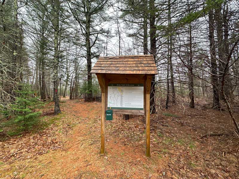
First, check your phone battery and take a paper copy of the map with you. Paper maps are available at the kiosks and in the Ross Center office.
To use the QR codes at the kiosks or in the office:
- Open Google Maps.
- Then, open your phone’s camera.
- Point the camera at the QR Code you want.
- Click the yellow button link at the bottom of your phone screen and the live Google map will open. (Note: if the trails do not open, retry the QR code. Older phones may not work proplerly.)
- The blue dot will follow you as you navigate the trails or anywhere on the property.
- Click on pins on the map for points of interest with photos and/or links.


Destination Maps – How to get to:
Scroll down this page for more destination maps descriptions, images and additional information. Or click here to download a pdf/printable version of destination maps with QR codes.
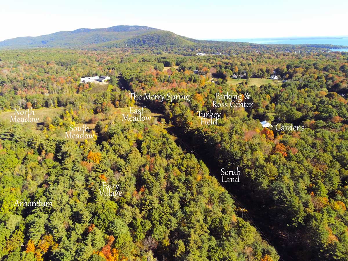
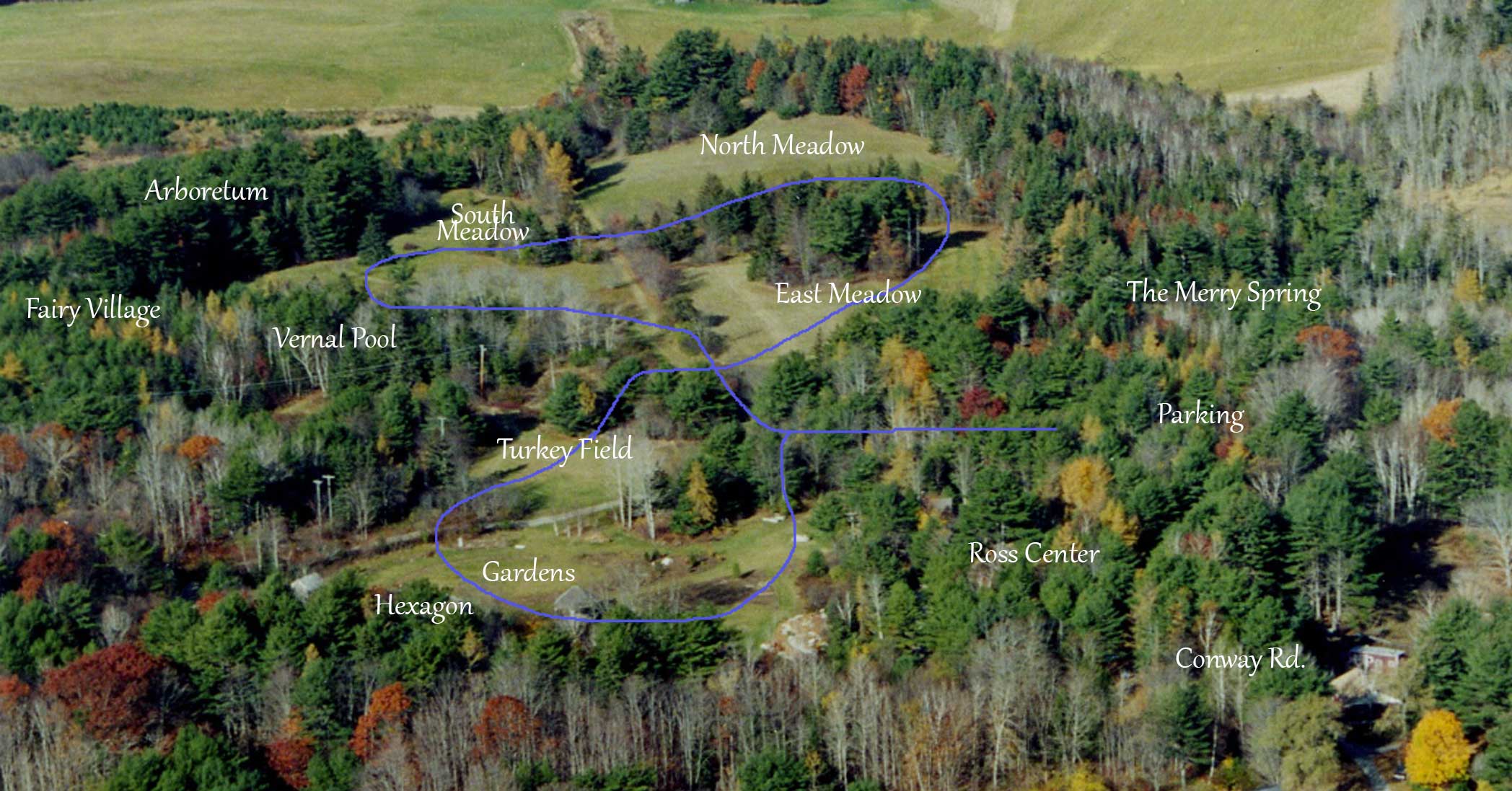
Fairy Village
A short walk from the gardens. Some tree roots once you enter the forest. Easy—199 yds.
Click on image for larger view.
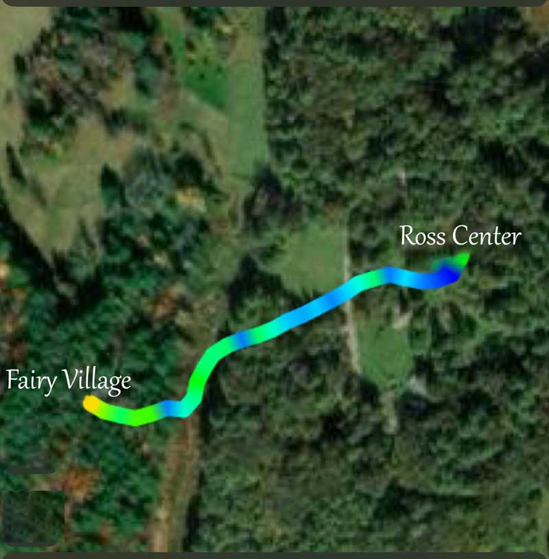
Fairy village is the spot for kids of all ages to play. Make new fairy houses or forts, borrow from existing ones or just play with the many structures in the area.

Kitty Todd Arboretum
Mowed trail to the Arboretum entrance. Easy, 137 yds. Forest trails in the Arboretum are up and down with tree roots etc., Intermediate—Multiple trails
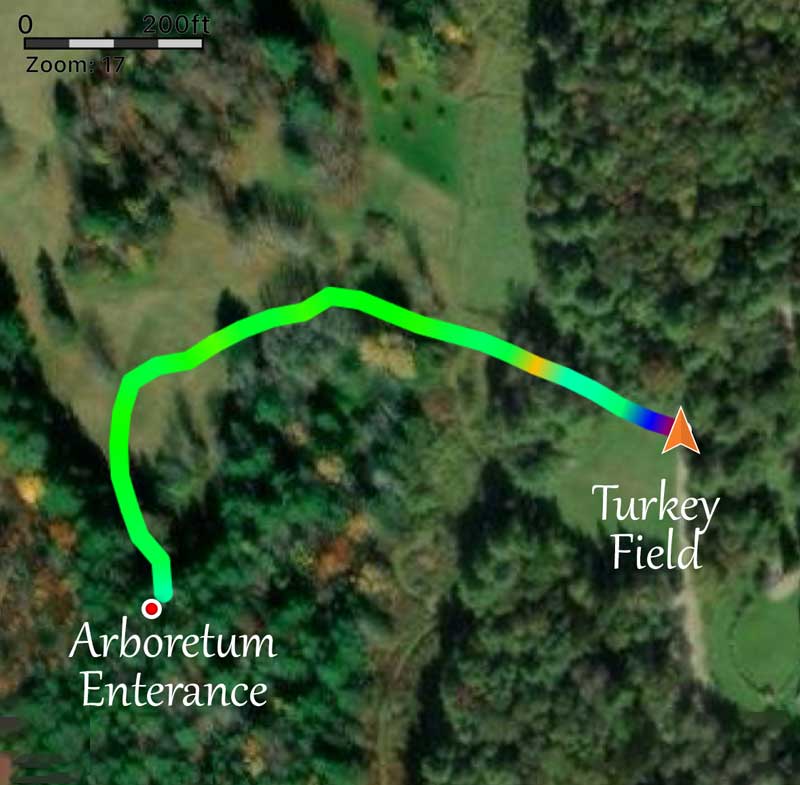
The Kitty Todd Aroretum has 35 named species of native trees on several well-marked trails. The trails go up and down across the terrain. Beautiful all year long.
The Merry Spring
Trail through the forest with tree roots and a sligh down hill. Steeper if you walk down to the spring. Intermediate—82 yds.
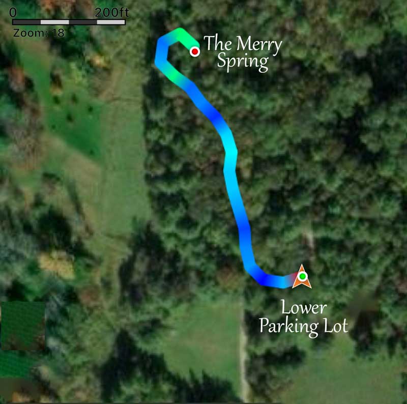
The Merry Spring was first used in the 1770’s and still has beautiful drinking water today.
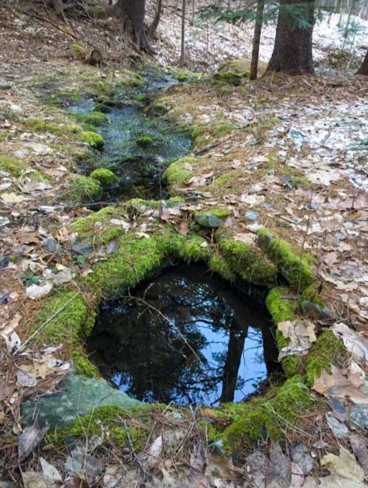
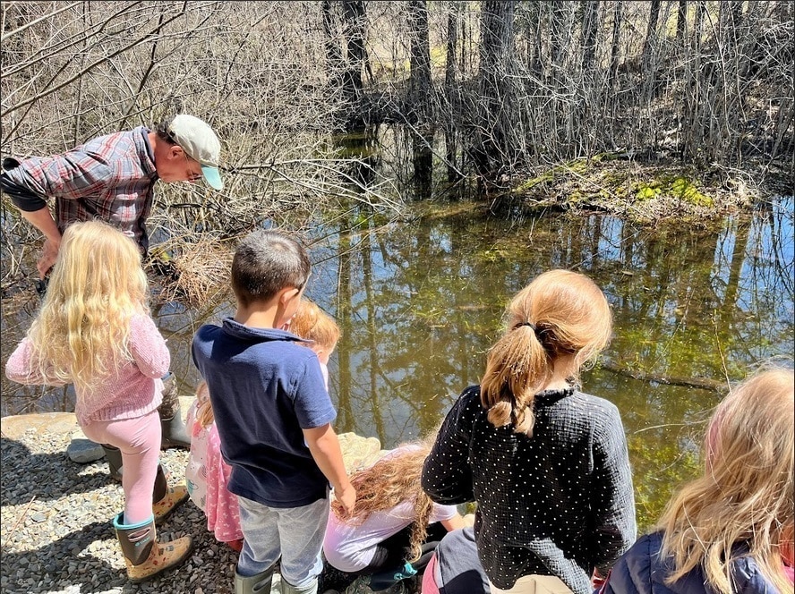
Vernal Pool
Mowed trails until the short walk into the forest with tree roots. Stone steps with no rail down to the viewing platform. Intermediate—47 yds.
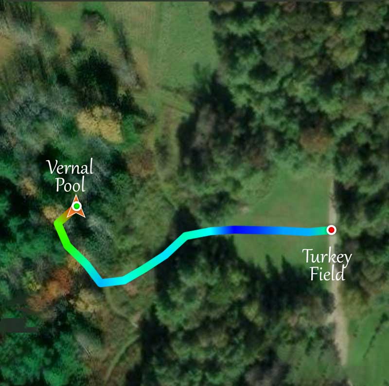
The vernal pool is the result of limestone quarrying in the 1800’s. Wood frogs and spotted salamanders return each year to spawn.
Interpretive Trail
Mowed trails on level ground. Trail by the vernal pool has tree roots.. Easy—.41 mile
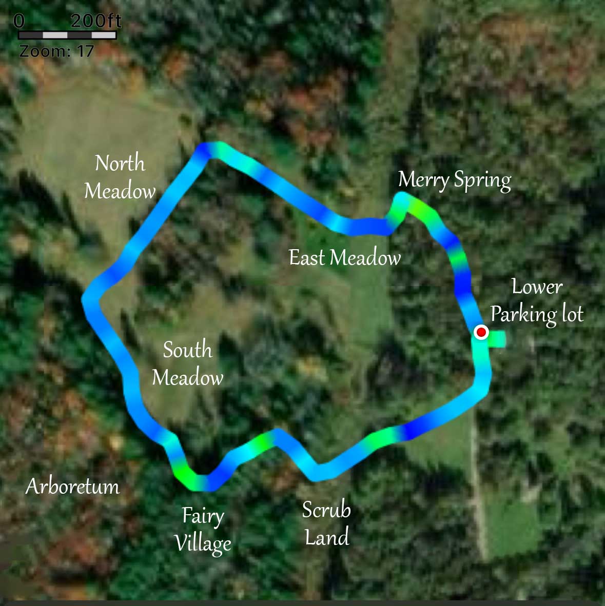
The Interpretive Trail (Yellow Trail) passes many of the highlights at Merryspring. This trail takes you around meadows with some short parts through forest.
A nice, easy, short walk
An easy walk at your own pace on level ground with mowed trails. Easy to turn around and get back to the parking lot.
Easy— .21 mile
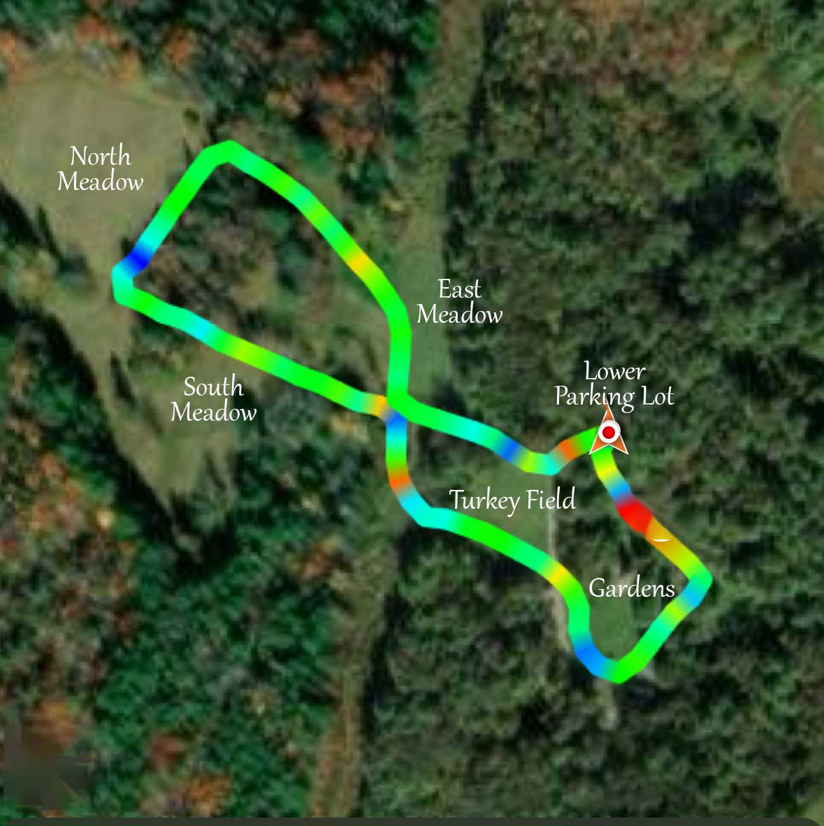
Looking for a short, easy walk to see birds, trees and insects? This route has no hills and several benches. Slighly uneven ground.
Merryspring is very grateful to BJ Richardson for volunteering his time and leading the development of custom Google Maps for our trails.
BJ Richardson is a seasoned conservation mapping professional with over 35 years of manual and GIS mapping experience, including 30 years with the U.S. Fish and Wildlife Service. Throughout his career, BJ led and contributed to numerous projects focused on preserving natural resources and advancing environmental stewardship through innovative mapping technologies.
He has worked at all scales, from small National Wildlife Refuge areas to National landscape-level conservation. BJ was an integral part of the team that developed the Nature’s Network landscape conservation design for the Northeast region. Driven by a passion for conservation, BJ remains committed to this vital work by supporting efforts that protect and sustain our natural landscapes for future generations.


